Eborienteers and Dawnay Estates are pleased to welcome you to a Regional (lev C) orienteering event at North Yorkshire Water Park – between Malton and
Scarborough – on Sunday 6th March 2022


Eborienteers and Dawnay Estates are pleased to welcome you to a Regional (lev C) orienteering event at North Yorkshire Water Park – between Malton and
Scarborough – on Sunday 6th March 2022

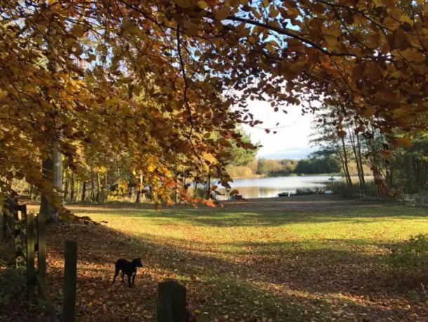
North Yorkshire Water Park comprises a large area of woodland, fields, lakes and leisure areas.
It includes one of the largest natural sports lakes in North Yorkshire, an all-terrain walking and cycle track, three well-stocked fishing lakes and several forests ideal for orienteering. In the last year, a great deal of time and investment has been made
creating the leisure park – featuring the AquaPark, Zipwire, Wakeboarding, Paddle boarding, Pedalos and (now) Orienteering.
Originally a series of gravel pits, a small part of the terrain (out of bounds – and not operating on Sundays) remains an active sand and gravel extraction plant. The remainder of the area is used for various leisure activities. This terrain has never been used before for orienteering at any level.
We are extremely grateful to Dawnay Estates for permitting access into this complex and interesting terrain for our orienteering event today.
Campsite and Caravan Park
As a special promotion for orienteers at North Yorkshire Water Park today, if anyone stays at North Yorkshire Water Park Caravan/camping/Campervan site for min 1 night and tells campsite reception (01723 865052) that they are attending the orienteering event, they will get a special discounted camping rate.
Water Park Cafe
If you want to go to the Water Park café, please wait till after your run, and then go there by car. It’s about 1.5km from the orienteering car park. Location should be obvious or ask an orienteering official. The café, zipwire and climbing facility will be open. The other facilities will be closed.
Dogs
There is no formal assembly area. Dogs permitted on a lead throughout the park, but not on orienteering courses.
We will try and have live results available
The venue will be signposted from the A170 near Hutton Buscel, 9km W of Scarborough and is located 1km S of the A170 between Wykeham and West Ayton. Car Park will be located here.
GR: SE983830
Nearest postcode YO13 9QU
Coordinates N54:14:01 W0:29:28
W3W greed.smelter.glow
Park your vehicle as instructed by the officials. We are keeping cars at a social distance. Parking is in a field which should be fine for small cars and vans. Larger coaches may be more of a challenge – if you plan to bring a coach, please contact the organiser (details below).
There will be no car key drop this event. There will be toilets provided in or adjacent to the car park.
NOTE that there is a site speed limit of 10mph. This will apply to cars heading for the orienteering parking as well as cars heading for the site café after their run!
The northern part of the terrain is parkland with a network of roads and paths through an area of lakes. However, in the southwest, the terrain is very different being rougher more technical forests with point features and offering a more demanding orienteering challenge.
The shorter courses (VSG to White) will be limited to the northern parkland. However the other courses use the more complex forest terrain in the SW.
There will be two starts. Both starts will be 150m from the car park. Sanitise hands before starting.
The finish for all courses will be approx. 150m from the car park
When entering on Fabian4, please choose your start time. The start layout will be designed to enable social distancing in line with Covid-19 guidelines.
Control descriptions will be marked on maps and will be available as loose
descriptions in the start lane.
Orange, yellow, and white courses will have textual descriptions, but other courses
will use symbolic control descriptions.
Download
Please ensure you download when you finish your course. Download will be positioned at a Covid safe position both for competitors and the download team. If you do have to queue, please maintain social distancing. If you have a query please
inform the download team from the side of the download area, at a social distance
Please comply with Covid procedures for distancing and sanitisation as requested. Please obey instructions of Start marshals.
Electronic chip hire £1 Senior & 50p Junior (note SIAC dibbers will not be available to hire)
| Course | Start | Length (km) | Climb (m) |
|---|---|---|---|
| Blue | East | 7.1 | 5 |
| Short Blue | East | 6.1 | 5 |
| Green | East | 5.0 | 5 |
| Short Green | West | 4.0 | 5 |
| Very Short Green | West | 3.1 | 5 |
| Light Green | West | 3.4 | 5 |
| Orange | West | 2.1 | 5 |
| Yellow | West | 1.7 | 0 |
| White | West | 0.9 | 0 |
SI electronic punching, SIAC enabled.
Download will be managed in a socially distant manner. If you have any queries or issues about your run subsequent to downloading, please notify download marshal who will either fix any computing problem or contact an event official if necessary on your behalf.
Although a thorough risk assessment has been conducted by the organiser, orienteering is an adventure sport and you are taking part at your own risk.
Results will be posted on the Eborienteers website as well as here, once the event has occurred. Please allow 24 hours.
Please follow the latest Government Covid-19 advice.
British Orienteering and EBORIENTEERS take their safeguarding responsibilities very seriously. Please report any concerns to either Eborienteers’ safeguarding lead (Amanda Cooper, acc_cm@hotmail.com ) or to British Orienteering (safeguarding@britishorienteering.org.uk ).
Some of the data you provide at registration (name, club and age class) will be used to publish results on our website. All other data required for insurance purposes will be kept for 5 years.
If you are not yet a member of an orienteering club affiliated to British Orienteering, we encourage you to join, and benefit from the membership advantages from British Orienteering and Eborienteers. Please ask any of our club officials for more information on how to join.
We have a policy on the taking of photographs at events, based on national guidance. This provides a sensible balance between the benefits and risks associated with the taking and use of images. If you are unsure about acceptable practice, please speak to the event organiser.